MINERAL EXPLORATION

The application of the mineral system concept is essential for the targeting process. The database must be interpreted at different scales, looking for significant features (e.g., biggest geological domains, translitospherical structures), mineralizing processes (e.g., host rocks, structures, hydrothermal halos), and immediate mineralizing processes (e.g.,  ore minerals). The need for deep targets makes exploration techniques more expensive, which requires maximized data evaluation to increase accuracy in defining ready-to-drill targets. Our advanced models and interpretations are based-on modern tools that can assess geological, structural, geophysical, geochemical, spectral, and remote sensing data, together with data-driven machine learning and high computational performance, speeding-up exploration, and discoveries.

Exploration Strategies

We know the exploration challenges and the hard work of executing an annual budget. We can support from artisanal mining to world-class operations, investors, and juniors to major companies. Each project scale, operation, and client have different needs. The implementation of an exploration program must consider several factors, such as mineral systems, endowment, new frontiers, technical merit, maturity, mineralization process, ore minerals, and minimum target. After the primary goal decision is essential to define or improve methodologies effectiveness, service scopes, provider’s choice, cost-benefits, logistics and operation during data acquisition, environmental and social permits, natural limitations, and many others.
Exploration Strategies

Full Database Evaluation

REVO GEOSCIENCE can provide a complete database evaluation of the mineral exploration project. We have experience and tools to evaluate all types of datasets, including geology, geophysics, geochemistry, structural, remote sensing, and spectral geology.

We know the need to evaluate an exploration database, performing QAQC, transformations, reprojections, conversions, statistics, and others. Integrating the data into a 3D platform and using a diversified tolls package, we can generate conceptual & geological-constraining models, define and re-evaluate exploration targets, define upside targets for farm-in evaluations, prepare teasers for farm-out and support an exploration drilling program.

The geological background is fundamental, so this service requires interaction and customer follow-up throughout the workflow. We also believe it essential to review the results and the delivered products. Reassessing the results with the exploration team, according to the evolution of knowledge and conceptual maturity of the project, is one of our premises.

Multi-scale Mineral System Interpretation and Targeting

The increasing demand for mineral resources is a reality. Large infrastructure projects, car electrification, the democratization of technology for society, and agro-industry inputs demand high production of base metals and other resources. The scarcity of world-class mining projects and the time required from the discovery to its implementation require companies with mineral exploration as a core business to accelerate their mineral exploration processes. This makes it necessary to carry out objective, innovative, and high-tech mineral exploration in known mineral provinces and explore new mineral frontiers.

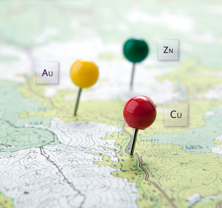
The REVO GEOSCIENCE team can support a targeting program in any part of the globe, from the compilation and processing of government data to exploration license definition and implementation of an exploration program. We have already supported and succeeded in new exploration licenses and discoveries. We have experience in interpreting mineral systems, at multi-scales and in different geological provinces, from the most awarded, with numerous known deposits to new mineral frontiers and with the scarcity of data.
Multi-scale Mineral System and Targeting

Advanced Geophysical Inversion and Interpretation

Geophysical data inversion has been the great leap in exploratory geophysics in the last 15 years. The 2.5D and 3D acquisition and deeper geophysical investigation are a reality. The modern and commercial inversion algorithms combined with the computational capacity available today can support decision-making and the next steps in the exploration strategy. Geophysical models tend to have greater geological coherence when we use high-density information and geological knowledge. Using previous forward modeling studies, geological models, combining more than one dataset, physical properties input, and mineral mineralogy, clear guidelines, such as depth and scale, results in a geophysical inversion that can generate consistent interpretation. Our team can produce forward modeling and unconstrained-constrained geophysical inversions. We can perform 1D, 2D, and 3D inversions of magnetic, gravimetric, electrical, electromagnetic and magnetotelluric data.

3D Geophysical Modelling for Basin Analysis
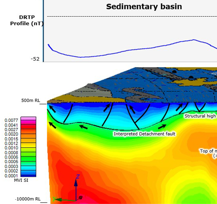
Base metal deposits in basins have large volumes and contents that can be disruptive and transform the economic value of a region, private, or state industry.  They are usually structurally controlled.  Mineral systems associated with sedimentary basins or volcano-sedimentary sequences can be better interpreted using 3D magnetic and gravity inversion, seismic, and multidisciplinary data integration.  The processing, interpretation, and integration of these datasets can support the mapping of tectonostratigraphic provinces of the basins, providing structural and deformation models, and controlling mineralizing processes, whether on a regional or project scale. This analysis can be helpful in mineral systems such as MVT, SEDEX, Cu-SHD, VMS, Epithermals, and others.
Advanced Geophysical Inversion and Interpretation_2

Advanced Exploratory Geochemistry

Geochemistry exploration is fundamental in exploration projects. Analytical results from the soil, chip sample, stream sediments, and pan concentrate always contribute to multi-scale exploration. When defining an exploration strategy, a geochemical campaign’s objectives are essential to define the methodology and analysis package. The technology of portable equipment like XRF and LIBS is already a reality. It can accelerate and reduce costs with laboratory analysis, but it has obstacles regarding detection limits and purposes of project audits. Undercover mineral exploration is increasingly common, and unconventional methods such as MMI and gas nanogeochemistry can help. Multi-elementary results, machine learning, statistics, associations such as PCA analysis, and pathfinder elements improve interpretations, supporting the footprint mineral deposits definitions, mineral targeting, vectorization, alteration halos, proximal or distal areas of a mineral system, and others.

Remote Sensing and Spectral Geology

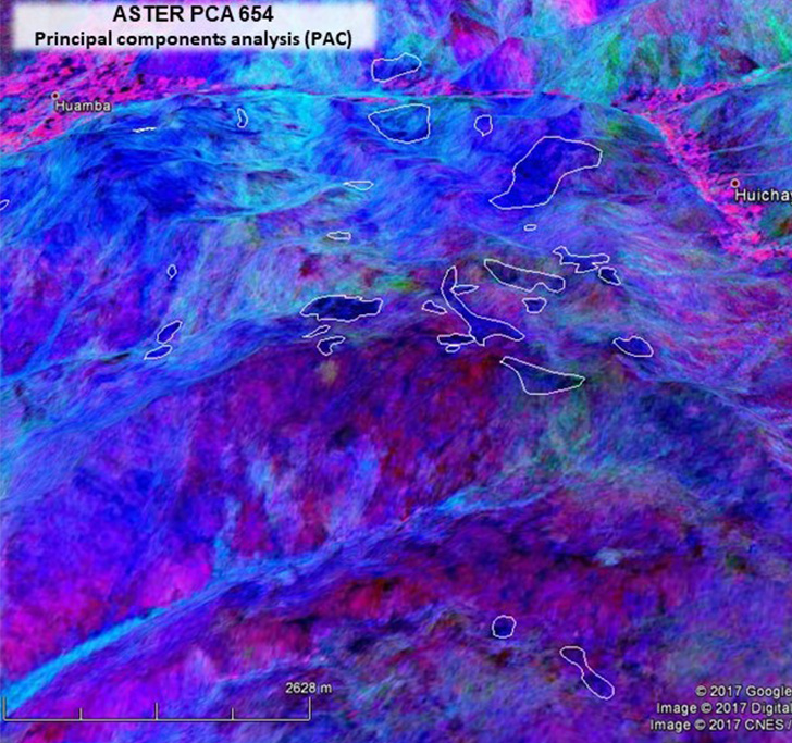
Remote Sensing and Spectral Geology are applied in multi-scale mineral exploration and contribute from logistics to direct vectorization of mineralized zones. Processing with modern tools applied to various sensors (e.g., Aster, Landsat, Alos Palsar, Sentinel, WordView) allows performing supervised or unsupervised classification, detection of spectral anomalies, soil classification, support for mapping, assessment of environmental impacts, and anthropic actions.

Reflectance spectroscopy can provide information on the composition, crystallinity, and relative abundance of alteration minerals and supports the identification of mineralizing processes and direct vectoring of mineralized zones. We can contribute with strategies, collections, processing, spectral interpretation, 3D modeling, and geometallurgical analysis.
remotesensing